Pothole and crack risks
Road damage and debris create safety hazards, but manual inspection alone can miss critical locations.
Multi-hazard detection
Detect potholes, cracks, FOD, and roadway asset anomalies in one analysis flow.


D-ROAD uses drone imagery and AI analytics to detect potholes, cracks, FOD, and roadway asset anomalies, then brings those findings into map-based review workflows for maintenance prioritization and field inspection planning.
Conventional inspections depend on time-intensive field work and delayed reporting. D-ROAD connects road data collection, AI analysis, dashboard review, and maintenance response in one workflow.
Road damage and debris create safety hazards, but manual inspection alone can miss critical locations.
Detect potholes, cracks, FOD, and roadway asset anomalies in one analysis flow.
Manual checks and sample-based surveys reduce coverage and increase repetitive work.
Capture wide road sections with drones and review them with AI-assisted analysis to improve survey efficiency.
When field information is separated from the review workspace, it becomes harder to organize response priorities.
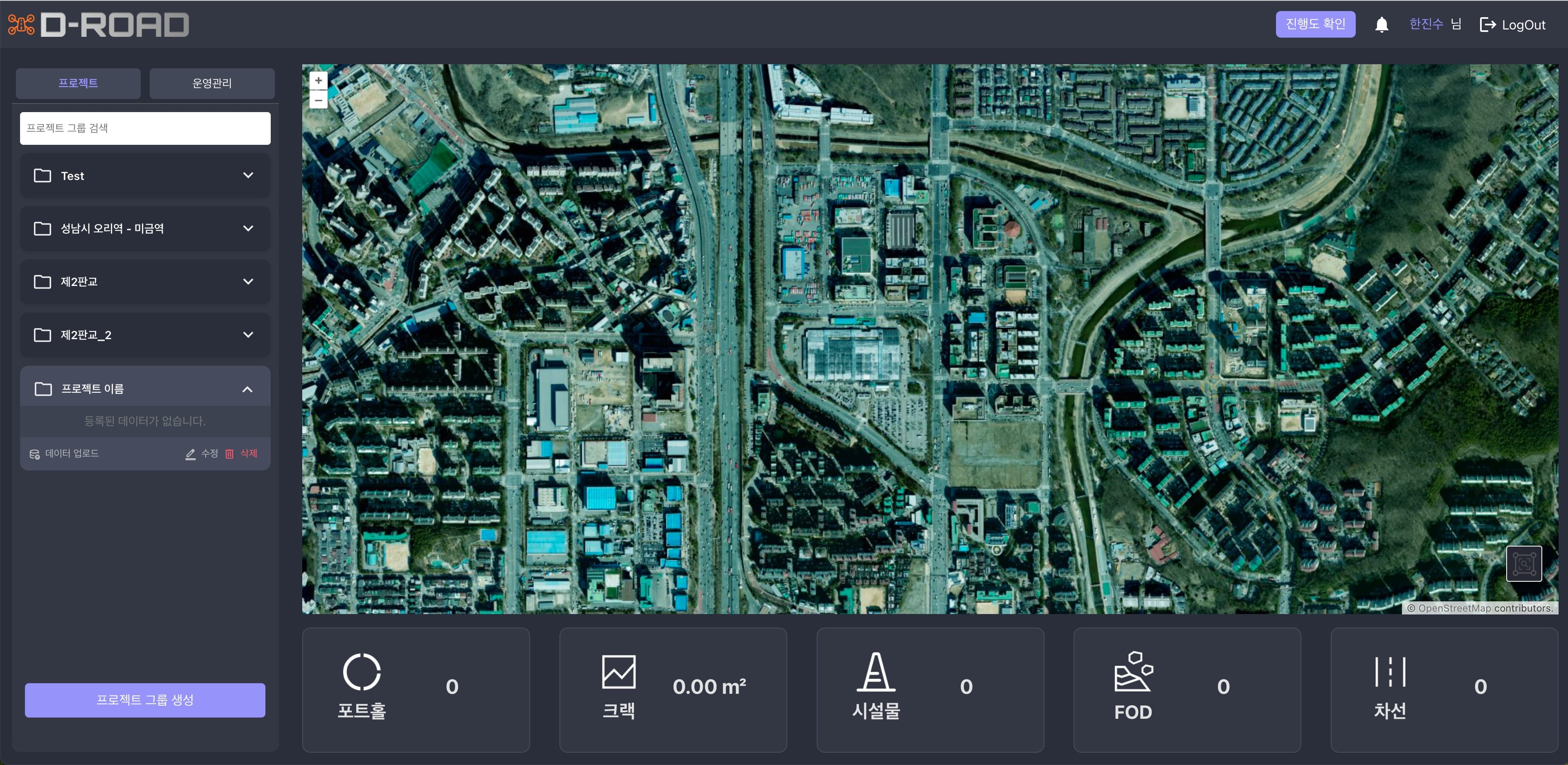
Review location, severity, and asset conditions together in one map-based workspace.
D-ROAD connects drone capture, AI detection, dashboard review, and field response into a single road safety pipeline.

Capture full road sections with drones to secure road-surface and asset data quickly.
Use AI-based analysis to detect and organize potholes, cracks, FOD, and asset anomalies.
Review location, severity, and section-level status in one map-based interface.
Turn alerts and priorities into inspection plans and maintenance actions.
D-ROAD identifies both pavement defects and roadway assets, so the output supports real maintenance planning instead of damage detection alone.

Quickly identify surface holes and severe damaged spots on the road.

Capture linear pavement damage and organize inspection priorities.

Detect foreign objects and obstacles on the roadway before they become incidents.

Recognize lane lines and road markings together with surface conditions.


Track manholes, traffic lights, signs, and drainage assets together.
CfSM (Car-free Street Mapping) removes vehicles and shadows to secure clearer pavement, markings, and asset boundaries. That cleaner input helps D-ROAD review pavement defects and roadway assets more consistently.
Remove vehicles and shadows so pavement and asset boundaries stay visible.
Lane markings, defects, and asset positions appear more clearly for stable detection input.
Reduce noisy inputs so teams can review detections and follow-up actions in a clearer workflow.
D-ROAD is most useful where road inspection, hazard review, and asset checks need to happen faster in real operating environments. These are the kinds of teams and workflows it fits best.

Use D-ROAD to review potholes, cracks, and FOD when public road teams need to organize inspection priorities.

Fit recurring inspections and asset checks in controlled road environments with frequent vehicle movement.

Help teams review detections with map context and connect hazard checks to field inspection and follow-up maintenance planning.
Use the demo to review AI detection results, map-based review flows, and facility management workflows.